2 418 030 SEK
BILDERNA LADDAS...
Mark (Till salu)
Referens:
EDEN-T98788662
/ 98788662
Referens:
EDEN-T98788662
Land:
GB
Stad:
Somerset
Postnummer:
TA22 9AF
Kategori:
Bostäder
Listningstyp:
Till salu
Fastighetstyp:
Mark
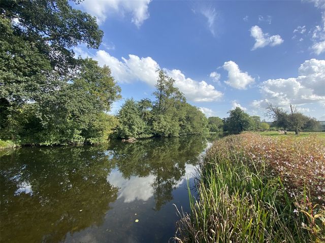


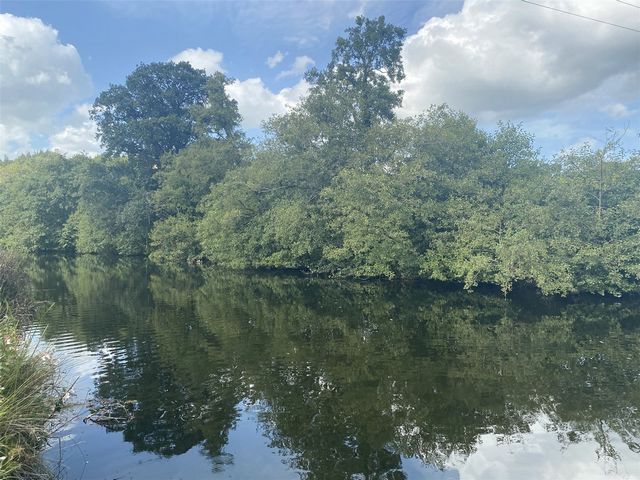
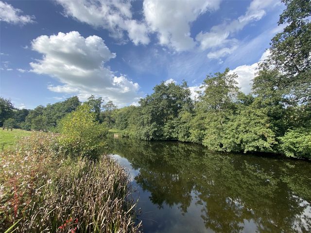
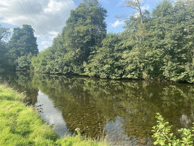
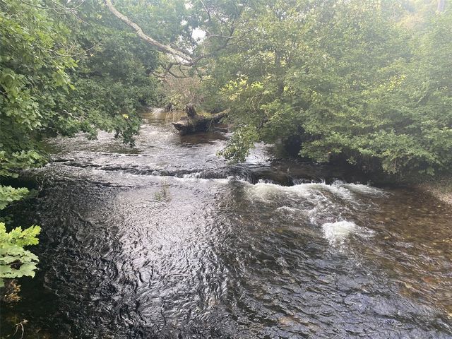

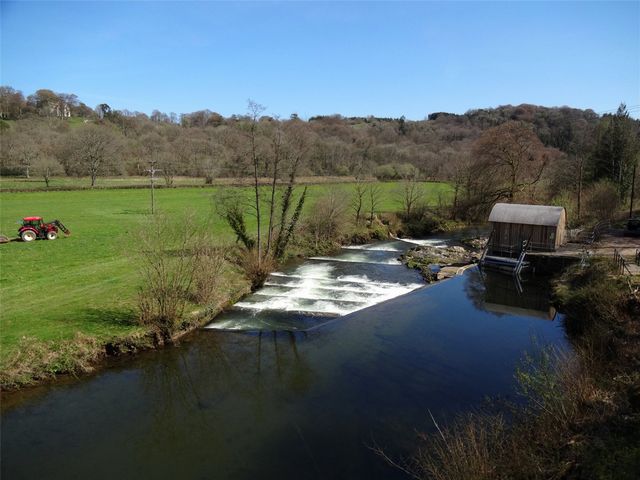

Running south from the outskirts of Dulverton to Perry Weir, just south of Brushford.
Formerly known as the A and B Beats of the then well-known Carnarvon Arms Hotel.The River Barle rises some 450 metres above sea level, within an area known as "The Chains" on the north west plateau of Exmoor. In the 1800s the Barle was damned at its source (Pinkery Pond) by the industrialist John Knight, to create a reservoir. The river flows south and then east to Simonsbath and Withypool collecting additional flow from the lesser known "Barle Water", "White Water", "Sherdon Water" and "Pennycombe Water" tributaries. From Withypool the river flows south east to Dulverton, passing through the historically renowned Tarr Steps (with its ancient stone "Clapper Bridge") and picks up further flow along the way from "West Water", "Little River" and "Danes Brook". Ultimately the river then passes through the fishing rights presently for sale, shortly after which it joins the River Exe at Exebridge. Exmoor is a sparsely wooded with steep sided "V" shaped valleys which broaden at Dulverton and south towards Exebridge.Whilst there are two "Beats" our clients wish to offer both for sale as one. They are however described as two separate "Beats" due to the historical nature of the fishing and due to each "Beats" own individual renown. BEAT "A"
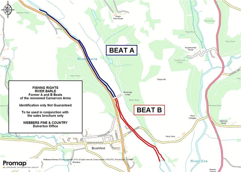
Double and single bank fishing on the Barle The left bank running from approximately the lower side of New Bridge to the Kissing Gate and Telegraph Pole Hedge two fields upstream. 811 yards (741 metres). The right bank runs from the lower side of New Bridge to the garden fence of Penlee, Dulverton (the first property on entering the outskirts of the town). 1473 yards (1347 metres). The stretch includes both named pools and The Salmon LeapBEAT "B"
Double bank fishing on the lower stretch of the Barle The left bank running from the bottom of Perry Weir to the lower side of New Bridge. 907 yards (830 metres). The right bank runs from the topside of the mill leat gate to the lower side of New Bridge. 1006 yards (920 metres).ACCESS
Access is on foot only. Please contact the agents for specific directions. However, as a general guide, it can be accessed from Dulverton at the very foot of Milhams Lane across the fields running south. Alternatively from either New Bridge or Iron Bridge. New Bridge is privately owned property and we would not recommend parking here. From Iron Bridge the fishing can be accessed in either direction. Again whilst the road here is public highway, we would recommend that you park with caution and care in an area allowing the free flow of any traffic.TENURE AND POSSESSION
The rights are for the sale and exclusive right of fishing and taking further fish together with the right to trim the banks, trees and bushes overhanging the river, to cut weeds and make pools for the purposes of such fishing rights.METHOD OF SALE
For sale by Private Treaty (reserving the rights to offer the same for sale by Informal Tender if necessary).PLANS
Identification only and not to scale.VIEWING
Viewing is strictly by appointment only please. Please contact Webbers Fine & Country Dulverton office on ... before viewing. All parties viewing the fishing do so at their own risk and are expected to take their own necessary safety precautions if inspecting the fishing rights. Viewing should only be carried out during day light hours. There may be livestock grazing the land adjoining so please do be careful and keep all gates closed at all times. Visa fler Visa färre Een werkelijk fantastisch stuk van zowel enkel- als dubbeloevervissen op de beroemde rivier de Barle.
Loopt zuidwaarts van de rand van Dulverton naar Perry Weir, net ten zuiden van Brushford.
Voorheen bekend als de A en B Beats van het toen nog bekende Carnarvon Arms Hotel.De rivier de Barle stijgt ongeveer 450 meter boven de zeespiegel, in een gebied dat bekend staat als "The Chains" op het noordwestelijke plateau van Exmoor. In de jaren 1800 werd de Barle aan de bron (Pinkery Pond) verdoemd door de industrieel John Knight, om een reservoir te creëren. De rivier stroomt naar het zuiden en vervolgens naar het oosten naar Simonsbath en Withypool en verzamelt extra stroom van de minder bekende zijrivieren "Barle Water", "White Water", "Sherdon Water" en "Pennycombe Water". Vanaf Withypool stroomt de rivier naar het zuidoosten naar Dulverton, passeert de historisch bekende Tarr Steps (met zijn oude stenen "Clapper Bridge") en pikt onderweg verder stroom op van "West Water", "Little River" en "Danes Brook". Uiteindelijk passeert de rivier dan de visrechten die momenteel te koop zijn, kort daarna voegt het zich bij de rivier de Exe bij Exebridge. Exmoor is een dunbeboste met steile "V"-vormige valleien die zich verbreden bij Dulverton en zuidwaarts richting Exebridge.Hoewel er twee "Beats" zijn, willen onze klanten beide als één te koop aanbieden. Ze worden echter beschreven als twee afzonderlijke "Beats" vanwege de historische aard van het vissen en vanwege de individuele bekendheid van elke "Beats". VERSLA "A"
Vissen met dubbele en enkele bank op de Barle: De linkeroever loopt van ongeveer de onderkant van New Bridge tot de Kissing Gate en Telegraph Pole Hedge, twee velden stroomopwaarts. 811 yards (741 meter). De rechteroever loopt van de onderkant van New Bridge naar het tuinhek van Penlee, Dulverton (het eerste eigendom bij het betreden van de rand van de stad). 1473 yards (1347 meter). Het stuk omvat zowel genoemde poelen als The Salmon LeapVERSLA "B"
Vissen op de dubbele oever op het lagere stuk van de Barle De linkeroever loopt van de onderkant van Perry Weir tot de onderkant van New Bridge. 907 yards (830 meter). De rechteroever loopt van de bovenzijde van de molenpoort tot de benedenzijde van de Nieuwe Brug. 1006 yards (920 meter).TOEGANG
De toegang is alleen te voet. Neem contact op met de agenten voor specifieke aanwijzingen. Als algemene richtlijn is het echter toegankelijk vanuit Dulverton aan de voet van Milhams Lane over de velden die naar het zuiden lopen. U kunt ook kiezen voor New Bridge of Iron Bridge. New Bridge is particulier eigendom en we zouden niet aanraden om hier te parkeren. Vanaf de IJzeren Brug is het vissen in beide richtingen bereikbaar. Nogmaals, hoewel de weg hier openbare weg is, raden we u aan voorzichtig en voorzichtig te parkeren in een gebied waar het verkeer vrij kan doorstromen.BEZIT EN BEZIT
De rechten hebben betrekking op de verkoop en het exclusieve recht om te vissen en meer vis te vangen, samen met het recht om de oevers, bomen en struiken die over de rivier hangen te snoeien, onkruid te wieden en poelen te maken voor de toepassing van dergelijke visrechten.WIJZE VAN VERKOOP
Te koop via een onderhandse overeenkomst (met behoud van het recht om hetzelfde indien nodig te koop aan te bieden via een informele aanbesteding).PLANNEN
Alleen identificatie en niet op schaal.BEKIJKEN
Bezichtiging is strikt alleen op afspraak. Neem voor de bezichtiging contact op met het kantoor van Webbers Fine & Country Dulverton op ... Alle partijen die de visserij bekijken, doen dit op eigen risico en worden geacht hun eigen noodzakelijke veiligheidsmaatregelen te nemen bij het inspecteren van de visrechten. Bezichtiging mag alleen overdag worden uitgevoerd. Er kan vee grazen op het aangrenzende land, dus wees voorzichtig en houd alle poorten te allen tijde gesloten. A truly superb stretch of both single and double bank fishing on the renowned River Barle.
Running south from the outskirts of Dulverton to Perry Weir, just south of Brushford.
Formerly known as the A and B Beats of the then well-known Carnarvon Arms Hotel.The River Barle rises some 450 metres above sea level, within an area known as "The Chains" on the north west plateau of Exmoor. In the 1800s the Barle was damned at its source (Pinkery Pond) by the industrialist John Knight, to create a reservoir. The river flows south and then east to Simonsbath and Withypool collecting additional flow from the lesser known "Barle Water", "White Water", "Sherdon Water" and "Pennycombe Water" tributaries. From Withypool the river flows south east to Dulverton, passing through the historically renowned Tarr Steps (with its ancient stone "Clapper Bridge") and picks up further flow along the way from "West Water", "Little River" and "Danes Brook". Ultimately the river then passes through the fishing rights presently for sale, shortly after which it joins the River Exe at Exebridge. Exmoor is a sparsely wooded with steep sided "V" shaped valleys which broaden at Dulverton and south towards Exebridge.Whilst there are two "Beats" our clients wish to offer both for sale as one. They are however described as two separate "Beats" due to the historical nature of the fishing and due to each "Beats" own individual renown. BEAT "A"
Double and single bank fishing on the Barle The left bank running from approximately the lower side of New Bridge to the Kissing Gate and Telegraph Pole Hedge two fields upstream. 811 yards (741 metres). The right bank runs from the lower side of New Bridge to the garden fence of Penlee, Dulverton (the first property on entering the outskirts of the town). 1473 yards (1347 metres). The stretch includes both named pools and The Salmon LeapBEAT "B"
Double bank fishing on the lower stretch of the Barle The left bank running from the bottom of Perry Weir to the lower side of New Bridge. 907 yards (830 metres). The right bank runs from the topside of the mill leat gate to the lower side of New Bridge. 1006 yards (920 metres).ACCESS
Access is on foot only. Please contact the agents for specific directions. However, as a general guide, it can be accessed from Dulverton at the very foot of Milhams Lane across the fields running south. Alternatively from either New Bridge or Iron Bridge. New Bridge is privately owned property and we would not recommend parking here. From Iron Bridge the fishing can be accessed in either direction. Again whilst the road here is public highway, we would recommend that you park with caution and care in an area allowing the free flow of any traffic.TENURE AND POSSESSION
The rights are for the sale and exclusive right of fishing and taking further fish together with the right to trim the banks, trees and bushes overhanging the river, to cut weeds and make pools for the purposes of such fishing rights.METHOD OF SALE
For sale by Private Treaty (reserving the rights to offer the same for sale by Informal Tender if necessary).PLANS
Identification only and not to scale.VIEWING
Viewing is strictly by appointment only please. Please contact Webbers Fine & Country Dulverton office on ... before viewing. All parties viewing the fishing do so at their own risk and are expected to take their own necessary safety precautions if inspecting the fishing rights. Viewing should only be carried out during day light hours. There may be livestock grazing the land adjoining so please do be careful and keep all gates closed at all times. Ein wirklich hervorragender Abschnitt zum Ein- und Zweiuferangeln am berühmten Fluss Barle.
Er verläuft südlich vom Stadtrand von Dulverton nach Perry Weir, südlich von Brushford.
Früher bekannt als die A und B Beats des damals bekannten Carnarvon Arms Hotels.Der Fluss Barle entspringt etwa 450 Meter über dem Meeresspiegel in einem Gebiet, das als "The Chains" auf dem nordwestlichen Plateau von Exmoor bekannt ist. In den 1800er Jahren wurde der Barle an seiner Quelle (Pinkery Pond) von dem Industriellen John Knight verdammt, um ein Reservoir zu schaffen. Der Fluss fließt nach Süden und dann nach Osten nach Simonsbath und Withypool und sammelt zusätzlichen Abfluss aus den weniger bekannten Nebenflüssen "Barle Water", "White Water", "Sherdon Water" und "Pennycombe Water". Von Withypool fließt der Fluss in südöstlicher Richtung nach Dulverton, passiert die historisch berühmten Tarr Steps (mit seiner alten steinernen "Clapper Bridge") und nimmt auf dem Weg von "West Water", "Little River" und "Danes Brook" weiteren Fluss auf. Schließlich durchquert der Fluss die derzeit zum Verkauf stehenden Fischereirechte und mündet kurz darauf bei Exebridge in den Fluss Exe. Exmoor ist ein dünn bewaldetes Tal mit steilen V-förmigen Tälern, die sich bei Dulverton und nach Süden in Richtung Exebridge verbreitern.Obwohl es zwei "Beats" gibt, möchten unsere Kunden beide als einen zum Verkauf anbieten. Sie werden jedoch aufgrund des historischen Charakters des Fischfangs und aufgrund des individuellen Rufs jedes "Beats" als zwei separate "Beats" beschrieben. SCHLAG "A"
Doppel- und Einuferfischen am Barle Das linke Ufer verläuft ungefähr von der unteren Seite der New Bridge bis zum Kissing Gate und der Telegraph Pole Hedge, zwei Felder flussaufwärts. 811 Yards (741 Meter). Das rechte Ufer verläuft von der unteren Seite der New Bridge bis zum Gartenzaun von Penlee, Dulverton (das erste Grundstück am Stadtrand). 1473 Yards (1347 Meter). Die Strecke umfasst sowohl benannte Pools als auch The Salmon LeapSCHLAG "B"
Doppeluferfischen am unteren Abschnitt des Barle Das linke Ufer verläuft vom Boden des Perry Weir bis zur unteren Seite der New Bridge. 907 Yards (830 Meter). Das rechte Ufer verläuft von der Oberseite des Mühlentors bis zur unteren Seite der New Bridge. 1006 Yards (920 Meter).ZUGANG
Der Zugang ist nur zu Fuß möglich. Bitte wenden Sie sich an die Agenten, um genaue Anweisungen zu erhalten. Als allgemeiner Leitfaden kann es jedoch von Dulverton aus am Fuße der Milhams Lane über die Felder nach Süden erreicht werden. Alternativ entweder von New Bridge oder Iron Bridge. New Bridge befindet sich in Privatbesitz und wir würden nicht empfehlen, hier zu parken. Von der Eisernen Brücke aus kann das Angeln in beide Richtungen erreicht werden. Auch hier ist die Straße eine öffentliche Straße, aber wir empfehlen Ihnen, mit Vorsicht und Vorsicht in einem Bereich zu parken, in dem der Verkehr frei fließen kann.BESITZ UND BESITZ
Die Rechte betreffen den Verkauf und das ausschließliche Recht zum Fischfang und zur Entnahme weiterer Fische sowie das Recht, die Ufer, Bäume und Büsche über dem Fluss zu beschneiden, Unkraut zu jäten und Tümpel für die Zwecke dieser Fischereirechte anzulegen.ART DES VERKAUFS
Freihändig zum Verkauf (mit dem Recht, diese bei Bedarf durch informelle Ausschreibung zum Verkauf anzubieten).PLANT
Nur Identifizierung und nicht maßstabsgetreu.BESICHTIGUNG
Die Besichtigung ist nur nach Vereinbarung möglich. Bitte kontaktieren Sie das Büro von Webbers Fine & Country Dulverton unter ... vor der Besichtigung. Alle Parteien, die den Fischfang beobachten, tun dies auf eigenes Risiko und es wird erwartet, dass sie bei der Inspektion der Fischereirechte ihre eigenen notwendigen Sicherheitsvorkehrungen treffen. Die Besichtigung sollte nur bei Tageslicht erfolgen. Auf dem angrenzenden Land kann Vieh weiden, also seien Sie bitte vorsichtig und halten Sie alle Tore immer geschlossen. Naprawdę wspaniały odcinek wędkarstwa jedno- i dwubrzegowego na słynnej rzece Barle.
Biegnie na południe od obrzeży Dulverton do Perry Weir, na południe od Brushford.
Dawniej znany jako A i B Beats znanego wówczas Carnarvon Arms Hotel.Rzeka Barle wznosi się na wysokość około 450 metrów nad poziomem morza, w obszarze znanym jako "The Chains" na północno-zachodnim płaskowyżu Exmoor. W 1800 roku Barle został przeklęty u źródła (Pinkery Pond) przez przemysłowca Johna Knighta, aby stworzyć zbiornik. Rzeka płynie na południe, a następnie na wschód do Simonsbath i Withypool, zbierając dodatkowe strumienie z mniej znanych dopływów "Barle Water", "White Water", "Sherdon Water" i "Pennycombe Water". Z Withypool rzeka płynie na południowy wschód do Dulverton, przechodząc przez historycznie słynne schody Tarr Steps (ze starożytnym kamiennym mostem "Clapper Bridge") i po drodze nabiera dalszego biegu z "West Water", "Little River" i "Danes Brook". Ostatecznie rzeka przepływa przez prawa połowowe obecnie wystawione na sprzedaż, po czym łączy się z rzeką Exe w Exebridge. Exmoor jest słabo zalesionym terenem ze stromymi dolinami w kształcie litery "V", które rozszerzają się w Dulverton i na południe w kierunku Exebridge.Chociaż istnieją dwa "Beats", nasi klienci chcą oferować oba na sprzedaż jako jeden. Są one jednak opisywane jako dwa oddzielne "Beats" ze względu na historyczny charakter połowu i ze względu na indywidualną renomę każdego z nich "Beats". UDERZENIE "A"
Wędkarstwo z podwójnego i pojedynczego brzegu na Barle Lewy brzeg biegnący mniej więcej od dolnej strony Nowego Mostu do Bramy Pocałunków i Żywopłotu ze Słupa Telegraficznego, dwa pola w górę rzeki. 811 jardów (741 metrów). Prawy brzeg biegnie od dolnej strony Nowego Mostu do ogrodzenia ogrodu Penlee, Dulverton (pierwsza posesja po wjeździe na obrzeża miasta). 1473 jardów (1347 metrów). Odcinek obejmuje zarówno nazwane baseny, jak i The Salmon LeapPOKONAJ "B"
Łowienie ryb z podwójnego brzegu na dolnym odcinku Barle Lewy brzeg biegnący od dna Perry Weir do dolnej strony New Bridge. 907 jardów (830 metrów). Prawy brzeg biegnie od górnej strony bramy młyńskiej do dolnej strony Nowego Mostu. 1006 jardów (920 metrów).DOSTĘP
Dojście jest tylko pieszo. Skontaktuj się z agentami, aby uzyskać szczegółowe wskazówki. Jednak jako ogólny przewodnik, można się do niego dostać z Dulverton u podnóża Milhams Lane przez pola biegnące na południe. Alternatywnie z Nowego Mostu lub Żelaznego Mostu. New Bridge jest własnością prywatną i nie polecamy parkowania tutaj. Z Żelaznego Mostu można dostać się do łowiska w obu kierunkach. Ponownie, chociaż droga w tym miejscu jest drogą publiczną, zalecamy parkowanie z zachowaniem ostrożności i ostrożności w miejscu umożliwiającym swobodny przepływ ruchu.PRAWO WŁASNOŚCI I POSIADANIE
Prawa te dotyczą sprzedaży i wyłącznego prawa do połowu ryb i połowu innych ryb wraz z prawem do przycinania brzegów, drzew i krzewów zwisających z rzeki, do wycinania chwastów i tworzenia sadzawek do celów takich praw połowowych.SPOSÓB SPRZEDAŻY
Na sprzedaż na podstawie umowy prywatnej (zastrzegając sobie prawo do oferowania tego samego na sprzedaż w drodze nieformalnego przetargu, jeśli zajdzie taka potrzeba).PLANY
Tylko identyfikacja, a nie skala.WYŚWIETLANIE
Oglądanie odbywa się wyłącznie po wcześniejszym umówieniu. Prosimy o kontakt z biurem Webbers Fine & Country Dulverton pod numerem ... przed obejrzeniem. Wszystkie strony dokonujące połowów robią to na własne ryzyko i oczekuje się od nich, że podejmą niezbędne środki ostrożności podczas inspekcji praw połowowych. Oglądanie powinno odbywać się tylko w godzinach dziennych. Na sąsiednich terenach mogą pasać się zwierzęta gospodarskie, dlatego należy zachować ostrożność i przez cały czas zamykać wszystkie bramy. Um trecho verdadeiramente soberbo de pesca de banco simples e duplo no renomado rio Barle.
Correndo para o sul dos arredores de Dulverton até Perry Weir, ao sul de Brushford.
Anteriormente conhecido como A e B Beats do então conhecido Carnarvon Arms Hotel.O rio Barle nasce a cerca de 450 metros acima do nível do mar, dentro de uma área conhecida como "The Chains" no planalto noroeste de Exmoor. Em 1800, o Barle foi condenado em sua nascente (Pinkery Pond) pelo industrial John Knight, para criar um reservatório. O rio flui para o sul e depois para o leste até Simonsbath e Withypool, coletando fluxo adicional dos afluentes menos conhecidos "Barle Water", "White Water", "Sherdon Water" e "Pennycombe Water". De Withypool, o rio flui para o sudeste até Dulverton, passando pela historicamente famosa Tarr Steps (com sua antiga pedra "Clapper Bridge") e pega mais fluxo ao longo do caminho de "West Water", "Little River" e "Danes Brook". Em última análise, o rio passa pelos direitos de pesca atualmente à venda, logo após o que se junta ao rio Exe em Exebridge. Exmoor é um escassamente arborizado com vales íngremes em forma de "V" que se alargam em Dulverton e ao sul em direção a Exebridge.Embora existam dois "Beats", nossos clientes desejam oferecer ambos para venda como um. Eles são, no entanto, descritos como dois "Beats" separados devido à natureza histórica da pesca e devido ao renome individual de cada "Beats". BATIDA "A"
Pesca de banco duplo e único no Barle A margem esquerda que vai aproximadamente do lado inferior da New Bridge até o Kissing Gate e o Telegraph Pole Hedge dois campos rio acima. 811 jardas (741 metros). A margem direita vai do lado inferior da New Bridge até a cerca do jardim de Penlee, Dulverton (a primeira propriedade ao entrar nos arredores da cidade). 1473 jardas (1347 metros). O trecho inclui piscinas nomeadas e The Salmon LeapBATIDA "B"
Pesca de banco duplo no trecho inferior do Barle A margem esquerda que vai do fundo do açude Perry até o lado inferior da New Bridge. 907 jardas (830 metros). A margem direita vai da parte superior do portão do moinho até o lado inferior da New Bridge. 1006 jardas (920 metros).ACESSO
O acesso é feito apenas a pé. Entre em contato com os agentes para obter instruções específicas. No entanto, como um guia geral, ele pode ser acessado a partir de Dulverton, no sopé da Milhams Lane, através dos campos que correm para o sul. Alternativamente de New Bridge ou Iron Bridge. New Bridge é propriedade privada e não recomendamos estacionar aqui. Da Ponte de Ferro, a pesca pode ser acessada em qualquer direção. Novamente, embora a estrada aqui seja uma via pública, recomendamos que você estacione com cautela e cuidado em uma área que permita o fluxo livre de qualquer tráfego.POSSE E POSSE
Os direitos são de venda e direito exclusivo de pesca e captura de mais peixes, juntamente com o direito de aparar as margens, árvores e arbustos pendentes do rio, cortar ervas daninhas e fazer piscinas para fins de tais direitos de pesca.MÉTODO DE VENDA
Para venda por Tratado Privado (reservando-se o direito de oferecer o mesmo para venda por Concurso Informal, se necessário).PLANOS
Apenas identificação e não em escala.VISUALIZAÇÃO
A visualização é estritamente com hora marcada, por favor. Entre em contato com o escritório da Webbers Fine & Country Dulverton no ... antes de ver. Todas as partes que visualizam a pesca o fazem por sua própria conta e risco e devem tomar suas próprias precauções de segurança necessárias se inspecionarem os direitos de pesca. A visualização só deve ser realizada durante o dia. Pode haver gado pastando na terra adjacente, portanto, tenha cuidado e mantenha todos os portões fechados o tempo todo. Поистине превосходный участок для рыбалки как на одном, так и на двух берегах на знаменитой реке Барль.
Идет на юг от окраины Далвертона до Перри Вейр, к югу от Брашфорда.
Ранее известный как A и B Beats известного в то время отеля Carnarvon Arms.Река Барл возвышается на высоте около 450 метров над уровнем моря, в районе, известном как «Цепи» на северо-западном плато Эксмура. В 1800-х годах Барл был проклят в своем истоке (пруд Пинкери) промышленником Джоном Найтом, чтобы создать водохранилище. Река течет на юг, а затем на восток до Саймонсбата и Уитипула, собирая дополнительный сток из менее известных притоков "Barle Water", "White Water", "Sherdon Water" и "Pennycombe Water". Из Уитипула река течет на юго-восток до Далвертона, проходя через исторически известную Таррскую лестницу (с ее древним каменным «Мостом Клэппера») и набирает дальнейшее течение по пути от «Западной воды», «Маленькой реки» и «Дейнс Брук». В конечном итоге река проходит через права на рыбную ловлю, которые в настоящее время выставлены на продажу, вскоре после чего она впадает в реку Экс в Эксебридже. Эксмур - это редкий лес с крутыми V-образными долинами, которые расширяются в Далвертоне и на юг в сторону Эксебриджа.Несмотря на то, что есть два «Beats», наши клиенты хотят предложить оба на продажу как один. Тем не менее, они описываются как два отдельных «Бита» из-за исторического характера промысла и из-за индивидуальной известности каждого «Бита». ТАКТ "А"
Рыбалка с двойным и одинарным берегом на Барле Левый берег простирается примерно от нижней стороны Нового моста до Целующих ворот и Телеграфной изгороди на два поля вверх по течению. 811 ярдов (741 метр). Правый берег проходит от нижней стороны Нового моста до садового забора Пенли, Далвертон (первая собственность при въезде на окраину города). 1473 ярда (1347 метров). Участок включает в себя как именные бассейны, так и прыжок лососяБИТ "B"
Рыбалка с двойным берегом на нижнем участке реки Барл Левый берег, идущий от дна плотины Перри до нижней стороны Нового моста. 907 ярдов (830 метров). Правый берег проходит от верхней стороны мельничных ворот до нижней стороны Нового моста. 1006 ярдов (920 метров).ДОСТУП
Доступ только пешком. Пожалуйста, свяжитесь с агентами для получения конкретных указаний. Тем не менее, в качестве общего ориентира, до него можно добраться из Далвертона у самого подножия Милхамс-лейн через поля, идущие на юг. Или от Нового моста или Железного моста. Новый мост находится в частной собственности, и мы бы не рекомендовали парковаться здесь. От Железного моста можно добраться до рыбалки в любом направлении. Опять же, несмотря на то, что дорога здесь является автомагистралью общего пользования, мы рекомендуем вам парковаться с осторожностью и осторожностью в зоне, где разрешено свободное движение любого транспорта.ВЛАДЕНИЕ И ВЛАДЕНИЕ
Речь идет о продаже и исключительном праве на рыбную ловлю и вылов рыбы, а также на подрезку берегов, деревьев и кустарников, нависающих над рекой, на вырубку водорослей и создание бассейнов для целей такого права на рыбную ловлю.СПОСОБ ПРОДАЖИ
Для продажи по частному договору (с сохранением права предложить то же самое для продажи в рамках неформального тендера, если это необходимо).ПЛАНЫ
Только идентификация и не масштабирование.ПРОСМОТР
Просмотр строго по предварительной записи, пожалуйста. Пожалуйста, свяжитесь с офисом Webbers Fine & Country Dulverton по телефону ... перед просмотром. Все стороны, наблюдающие за промыслом, делают это на свой страх и риск и, как ожидается, примут необходимые меры безопасности при проверке прав на промысел. Просмотр следует осуществлять только в светлое время суток. На прилегающей земле может пасться домашний скот, поэтому, пожалуйста, будьте осторожны и всегда держите все ворота закрытыми. Un tramo realmente magnífico de pesca en una y dos orillas en el famoso río Barle.
Corriendo hacia el sur desde las afueras de Dulverton hasta Perry Weir, justo al sur de Brushford.
Anteriormente conocido como los Beats A y B del entonces conocido Carnarvon Arms Hotel.El río Barle se eleva a unos 450 metros sobre el nivel del mar, dentro de un área conocida como "Las Cadenas" en la meseta noroeste de Exmoor. En la década de 1800, el Barle fue represado en su fuente (Pinkery Pond) por el industrial John Knight, para crear un embalse. El río fluye hacia el sur y luego hacia el este hasta Simonsbath y Withypool recogiendo el caudal adicional de los afluentes menos conocidos "Barle Water", "White Water", "Sherdon Water" y "Pennycombe Water". Desde Withypool, el río fluye hacia el sureste hasta Dulverton, pasando por los históricamente famosos Tarr Steps (con su antiguo "Clapper Bridge") de piedra y recoge más caudal a lo largo del camino desde "West Water", "Little River" y "Danes Brook". En última instancia, el río pasa a través de los derechos de pesca actualmente en venta, poco después de lo cual se une al río Exe en Exebridge. Exmoor es un valle escasamente boscoso con valles escarpados en forma de "V" que se ensanchan en Dulverton y hacia el sur hacia Exebridge.Si bien hay dos "Beats", nuestros clientes desean ofrecer ambos a la venta como uno solo. Sin embargo, se describen como dos "Beats" separados debido a la naturaleza histórica de la pesca y debido a la propia reputación individual de cada "Beats". RITMO "A"
Pesca en dos y una sola orilla en el Barle: La orilla izquierda se extiende desde aproximadamente el lado inferior del Puente Nuevo hasta la Puerta del Beso y el Seto del Polo del Telégrafo dos campos río arriba. 811 yardas (741 metros). La orilla derecha se extiende desde el lado inferior de New Bridge hasta la valla del jardín de Penlee, Dulverton (la primera propiedad al entrar en las afueras de la ciudad). 1473 yardas (1347 metros). El tramo incluye tanto piscinas con nombre como The Salmon LeapRITMO "B"
Pesca en doble orilla en el tramo inferior del Barle: La orilla izquierda que va desde la parte inferior de Perry Weir hasta el lado inferior de New Bridge. 907 yardas (830 metros). La orilla derecha se extiende desde la parte superior de la puerta del molino hasta el lado inferior del Puente Nuevo. 1006 yardas (920 metros).ACCESO
El acceso es solo a pie. Póngase en contacto con los agentes para obtener instrucciones específicas. Sin embargo, como guía general, se puede acceder desde Dulverton al pie de Milhams Lane a través de los campos que corren hacia el sur. Alternativamente, desde el Puente Nuevo o el Puente de Hierro. New Bridge es una propiedad privada y no recomendamos aparcar aquí. Desde el Puente de Hierro se puede acceder a la pesca en cualquier dirección. Una vez más, aunque la carretera aquí es una carretera pública, le recomendamos que estacione con precaución y cuidado en un área que permita el libre flujo de cualquier tráfico.TENENCIA Y POSESIÓN
Los derechos son para la venta y el derecho exclusivo de pescar y capturar más peces junto con el derecho a podar las orillas, árboles y arbustos que sobresalen del río, cortar malezas y hacer estanques para los fines de dichos derechos de pesca.MÉTODO DE VENTA
A la venta por Contrato Privado (reservándose los derechos de ofrecer el mismo a la venta por Licitación Informal si es necesario).PLANES
Solo identificación y no a escala.VISIONADO
La visita es estrictamente con cita previa, por favor. Póngase en contacto con la oficina de Webbers Fine & Country Dulverton en el ... antes de verlo. Todas las partes que observan la pesca lo hacen bajo su propio riesgo y se espera que tomen las precauciones de seguridad necesarias si inspeccionan los derechos de pesca. La visualización solo debe realizarse durante las horas de luz del día. Es posible que haya ganado pastando en la tierra contigua, así que tenga cuidado y mantenga todas las puertas cerradas en todo momento. Un tratto davvero superbo di pesca sia a singola che a doppia sponda sul rinomato fiume Barle.
Corre a sud dalla periferia di Dulverton a Perry Weir, appena a sud di Brushford.
Precedentemente noto come A e B Beats dell'allora noto Carnarvon Arms Hotel.Il fiume Barle sorge a circa 450 metri sul livello del mare, all'interno di un'area conosciuta come "Le Catene" sull'altopiano nord-occidentale di Exmoor. Nel 1800 il Barle fu dannato alla sua sorgente (Pinkery Pond) dall'industriale John Knight, per creare un bacino idrico. Il fiume scorre a sud e poi a est verso Simonsbath e Withypool raccogliendo ulteriore flusso dai meno noti affluenti "Barle Water", "White Water", "Sherdon Water" e "Pennycombe Water". Da Withypool il fiume scorre a sud-est fino a Dulverton, passando attraverso la storica e rinomata Tarr Steps (con il suo antico "Clapper Bridge" in pietra) e riprende ulteriore flusso lungo il percorso da "West Water", "Little River" e "Danes Brook". Alla fine il fiume passa attraverso i diritti di pesca attualmente in vendita, poco dopo si unisce al fiume Exe a Exebridge. Exmoor è una valle a forma di "V" scarsamente boscosa con ripidi fianchi che si allargano a Dulverton e a sud verso Exebridge.Mentre ci sono due "Beats", i nostri clienti desiderano offrire entrambi in vendita come uno. Essi sono tuttavia descritti come due "Beats" separati a causa della natura storica della pesca e a causa della fama individuale di ciascuno "Beats". BATTI "A"
Pesca a doppia e singola sponda sul Barle La riva sinistra che va approssimativamente dal lato inferiore del New Bridge al Kissing Gate e al Telegraph Pole Hedge due campi a monte. 811 iarde (741 metri). La riva destra va dal lato inferiore del New Bridge alla recinzione del giardino di Penlee, Dulverton (la prima proprietà entrando nella periferia della città). 1473 iarde (1347 metri). Il tratto comprende sia le piscine con nome che il Salmon LeapBATTI "B"
Pesca a doppia sponda sul tratto inferiore del Barle La riva sinistra che va dal fondo di Perry Weir al lato inferiore di New Bridge. 907 iarde (830 metri). La riva destra va dalla parte superiore della porta del mulino al lato inferiore del Ponte Nuovo. 1006 iarde (920 metri).ACCESSO
L'accesso è solo a piedi. Si prega di contattare gli agenti per indicazioni specifiche. Tuttavia, come guida generale, è possibile accedervi da Dulverton ai piedi di Milhams Lane attraverso i campi che corrono verso sud. In alternativa dal Ponte Nuovo o dal Ponte di Ferro. New Bridge è una proprietà privata e non consigliamo di parcheggiare qui. Dal Ponte di Ferro si può accedere alla pesca in entrambe le direzioni. Anche in questo caso, anche se la strada qui è pubblica, si consiglia di parcheggiare con cautela e attenzione in un'area che consenta il libero flusso di qualsiasi traffico.POSSESSO E POSSESSO
I diritti riguardano la vendita e il diritto esclusivo di pesca e di cattura di altri pesci, nonché il diritto di potare le sponde, gli alberi e i cespugli a strapiombo sul fiume, di tagliare le erbacce e di creare pozze d'acqua ai fini di tali diritti di pesca.MODALITA' DI VENDITA
In vendita a trattativa privata (riservandosi il diritto di offrire lo stesso in vendita tramite gara informale, se necessario).PIANI
Solo identificazione e non in scala.VISUALIZZAZIONE
La visione è rigorosamente su appuntamento, si prega di pregare. Si prega di contattare l'ufficio Webbers Fine & Country Dulverton al numero ... prima della visione. Tutte le parti che osservano la pesca lo fanno a proprio rischio e pericolo e sono tenute a prendere le necessarie precauzioni di sicurezza durante l'ispezione dei diritti di pesca. La visione deve essere effettuata solo durante le ore diurne. Potrebbe esserci del bestiame che pascola nel terreno adiacente, quindi si prega di fare attenzione e di tenere tutti i cancelli chiusi in ogni momento.