BILDERNA LADDAS...
Mark (Till salu)
16 000 m²
Referens:
EDEN-T102424843
/ 102424843
Referens:
EDEN-T102424843
Land:
PT
Stad:
Bensafrim e Barao De Sao Joao
Kategori:
Bostäder
Listningstyp:
Till salu
Fastighetstyp:
Mark
Fastighets storlek:
16 000 m²
Byggbart område:
16 280 m²
REAL ESTATE PRICE PER M² IN NEARBY CITIES
| City |
Avg price per m² house |
Avg price per m² apartment |
|---|---|---|
| Luz | 61 030 SEK | 53 451 SEK |
| Budens | 47 579 SEK | - |
| Portimão | 35 418 SEK | 38 743 SEK |
| Alcantarilha | 40 147 SEK | - |
| Algoz | 32 082 SEK | - |
| Guia | 51 231 SEK | - |
| Albufeira | 46 069 SEK | 44 578 SEK |
| Albufeira | 49 465 SEK | 45 782 SEK |
| Faro | 40 227 SEK | 45 082 SEK |
| Boliqueime | 42 418 SEK | - |
| Quarteira | 59 676 SEK | 56 555 SEK |
| Faro | 43 098 SEK | 44 306 SEK |
| Estoi | 43 646 SEK | - |
| São Brás de Alportel | 32 697 SEK | 28 383 SEK |
| São Brás de Alportel | 31 356 SEK | 27 311 SEK |
| Olhão | 36 702 SEK | 41 158 SEK |
| Olhão | 36 414 SEK | 37 196 SEK |
| Moncarapacho | 42 359 SEK | - |
| Fuseta | 38 234 SEK | - |
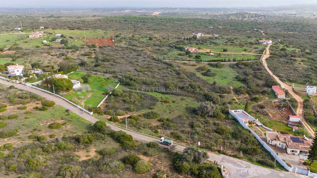
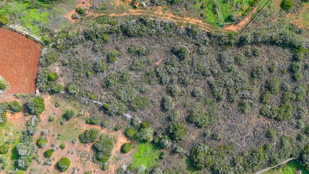
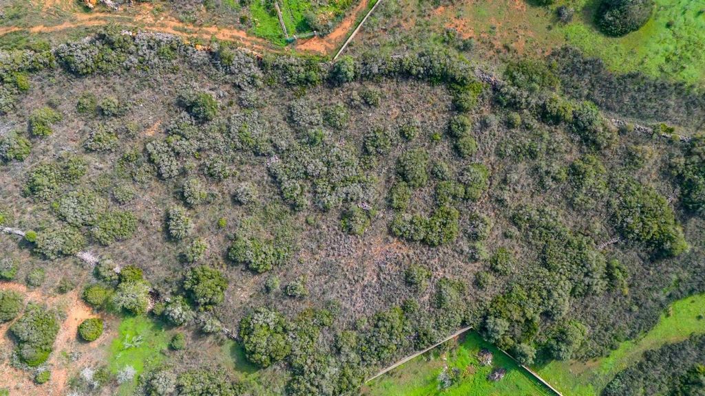
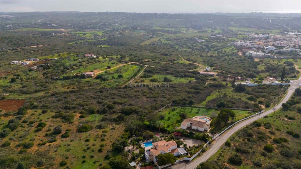
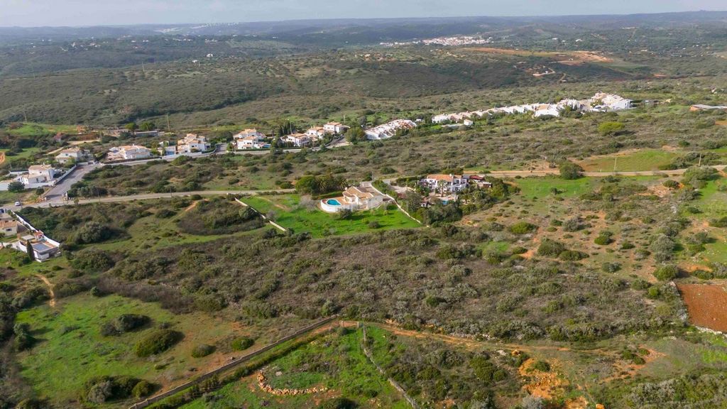
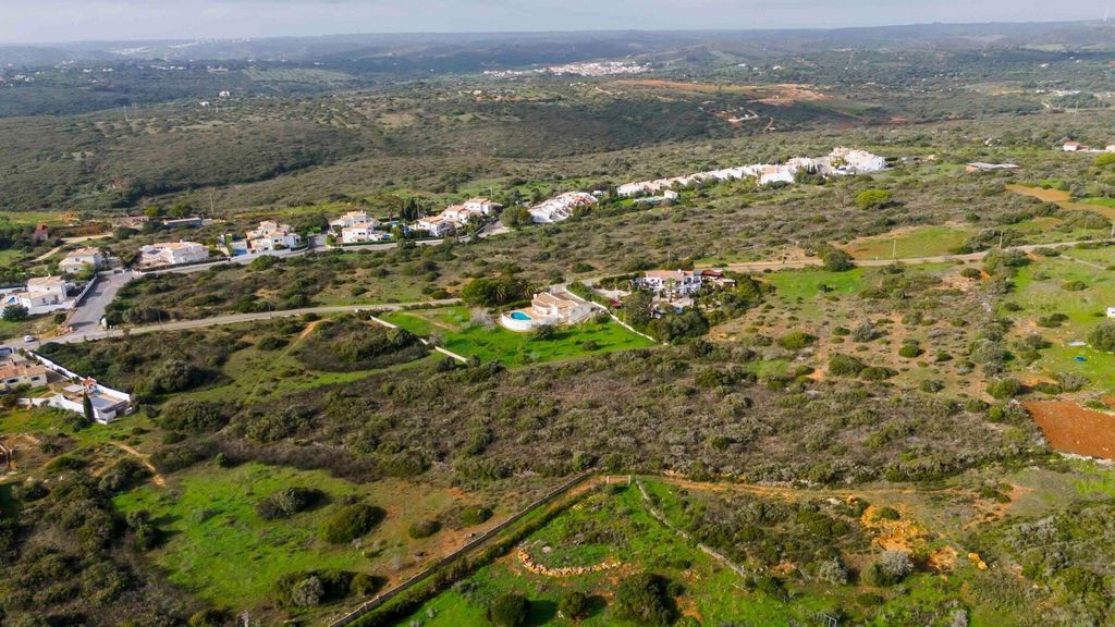
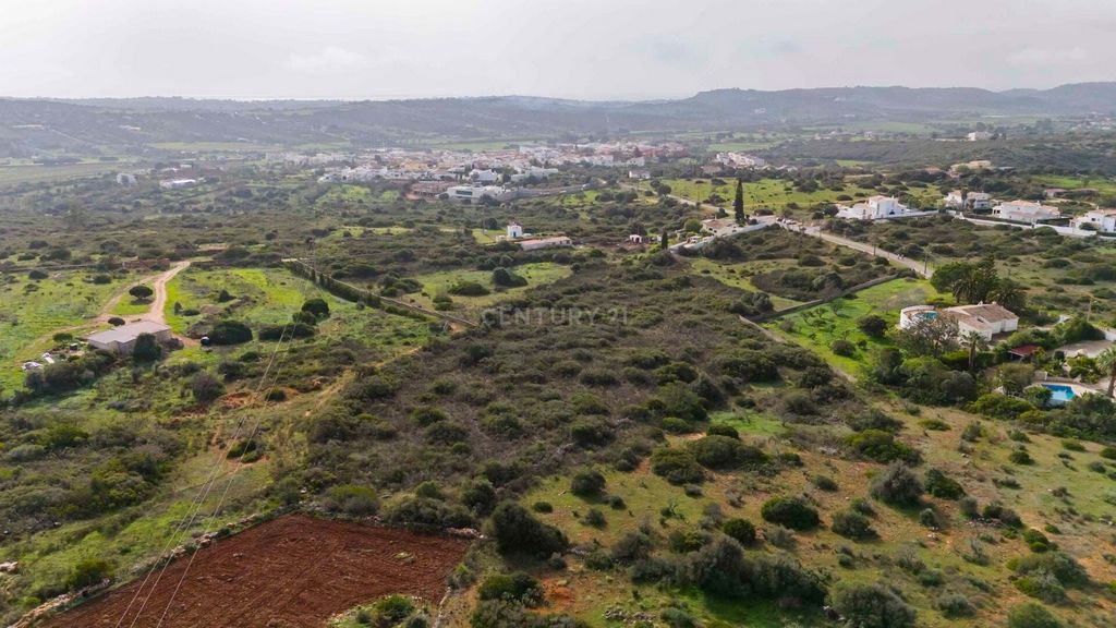
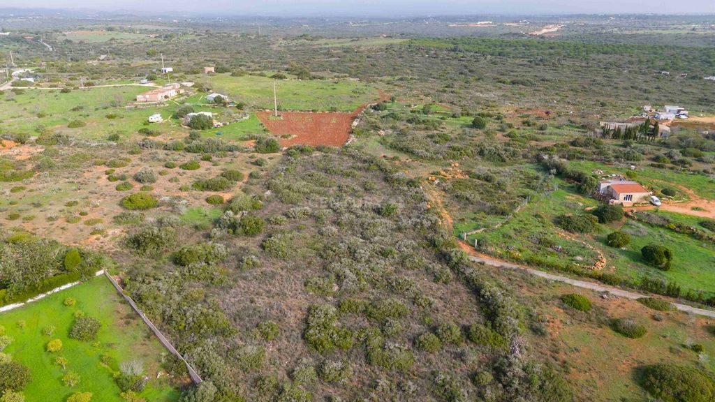

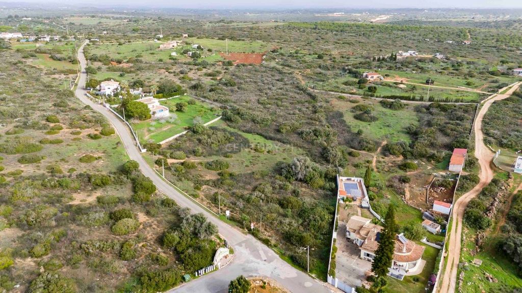
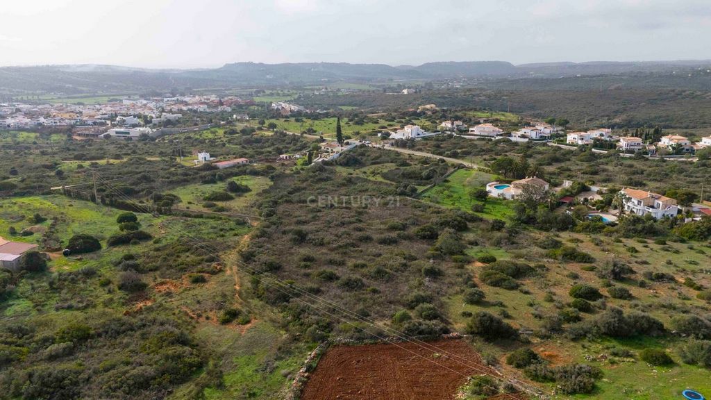
The land is not walled. It was once cultivated with almond trees and now has arable crops, namely olive and holm oak trees.
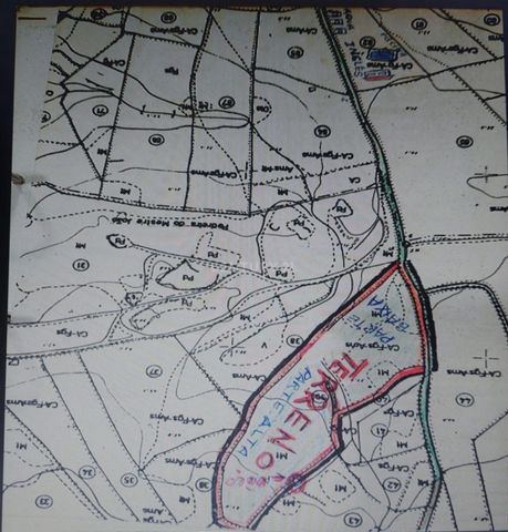
As well as being next to the road, it also has a well. It is irregularly shaped with high and low areas. Almádena is a village in the western Algarve (Barlavento). Administratively it is part of the parish of Luz, and the municipality of Lagos. Etymology
The place name 'Almádena' has an Arab origin, like many place names in the area. The name derives from the Arabic word for the minaret (al-Madin). Geography
Almádena's location is on the edge of fertile sedimentary deposits. In the past, local farmers concentrated on growing figs rather than almonds, olives or carobs, which were more ubiquitous to the east. However, an additional crop, rice, flourished and was consequently cultivated in the irrigable lowlands south-west of the village. If you would like to visit, before we arrange a visit, here are the geographical coordinates:
-57 133.20
-284 056.42
Coordinate system ETRS89 PT-TM06 Visa fler Visa färre Terreno rústico, situado em Cerro Moinho, terreno de boa qualidade para fins agrícolas com área total de 1.628 HA.
Encontra-se junto à Urbanização Cerro do Moinho, na freguesia de Bensafrim e Barão de São João.
O terreno não está murado. Já teve cultura de Amendoeiras e tem Cultura arvense, nomeadamente oliveiras e azinheiras.
Além de estar junto à estrada, também tem um poço.
Apresenta um formato irregular com zona alta e baixa.Almádena é uma aldeia no Algarve ocidental (Barlavento). Administrativamente faz parte da freguesia de Luz, e do município de Lagos.Etimologia
O toponim 'Almádena' tem uma origem árabe, como muitos nomes de lugares na área. O nome deriva da palavra árabe para o minarete (al-Madin).Geografia
A localização de Almádena está à beira de depósitos sedimentares férteis. No passado, os agricultores locais se concentravam no cultivo de figo em vez de amêndoas, azeitonas ou alfarroba, que eram mais ubíquos a leste. No entanto, uma colheita adicional, o arroz, floresceu e consequentemente era cultivada nas terras baixas irrigáveis sul oeste da aldeia.Caso pretenda visitar, antes de marcarmos visita, aqui ficam as coordenadas geográficas:
-57 133.20
-284 056.42
Sistema de coordenadas ETRS89 PT-TM06
ou
37º 06' 10.1N
8º 46' 14.9W Rustic land, located in Cerro Moinho, good quality land for agricultural purposes with a total area of 1,628 HA. It is next to the Cerro do Moinho Urbanisation, in the parish of Bensafrim and Barão de São João.
The land is not walled. It was once cultivated with almond trees and now has arable crops, namely olive and holm oak trees.
As well as being next to the road, it also has a well. It is irregularly shaped with high and low areas. Almádena is a village in the western Algarve (Barlavento). Administratively it is part of the parish of Luz, and the municipality of Lagos. Etymology
The place name 'Almádena' has an Arab origin, like many place names in the area. The name derives from the Arabic word for the minaret (al-Madin). Geography
Almádena's location is on the edge of fertile sedimentary deposits. In the past, local farmers concentrated on growing figs rather than almonds, olives or carobs, which were more ubiquitous to the east. However, an additional crop, rice, flourished and was consequently cultivated in the irrigable lowlands south-west of the village. If you would like to visit, before we arrange a visit, here are the geographical coordinates:
-57 133.20
-284 056.42
Coordinate system ETRS89 PT-TM06 Terrain rustique, situé à Cerro Moinho, de bonne qualité, à usage agricole, d'une superficie totale de 1,628 ha, à proximité de l'urbanisation de Cerro do Moinho, dans la paroisse de Bensafrim et Barão de São João.
Le terrain n'est pas clôturé. Autrefois cultivé en amandiers, il présente aujourd'hui des cultures arables, notamment des oliviers et des chênes verts.
En plus d'être situé à proximité de la route, il dispose d'un puits. Il a une forme irrégulière avec des zones hautes et basses. Almádena est un village de l'Algarve occidental (Barlavento). Administrativement, il fait partie de la paroisse de Luz et de la municipalité de Lagos.Étymologie
Le toponyme "Almádena" est d'origine arabe, comme de nombreux toponymes de la région. Le nom dérive du mot arabe désignant le minaret (al-Madin). Géographie L'emplacement d'Almádena se trouve à la limite de dépôts sédimentaires fertiles. Dans le passé, les agriculteurs locaux se sont concentrés sur la culture des figues plutôt que sur celle des amandes, des olives ou des caroubes, plus répandues à l'est. Cependant, une autre culture, le riz, a prospéré et a donc été cultivée dans les basses terres irrigables au sud-ouest du village. Si vous souhaitez visiter, avant que nous n'organisions une visite, voici les coordonnées géographiques : ... Système de coordonnées ETRS89 PT-TM06 Terreno rustico, situato a Cerro Moinho, terreno di buona qualità per scopi agricoli con una superficie totale di 1.628 HA. Si trova vicino all'urbanizzazione del Cerro do Moinho, nella parrocchia di Bensafrim e Barão de São João.
Il terreno non è murato. Un tempo coltivata a mandorli e ora ha seminativi, in particolare ulivi e lecci.
Oltre ad essere vicino alla strada, ha anche un pozzo. Ha una forma irregolare con zone alte e basse. Almádena è un villaggio dell ' Algarve occidentale (Barlavento). Amministrativamente fa parte della parrocchia di Luz e del comune di Lagos. Etimologia
Il toponimo 'Almádena' ha un'origine araba, come molti toponimi della zona. Il nome deriva dalla parola araba che significa minareto (al-Madin). Geografia
La posizione di Almádena si trova ai margini di fertili depositi sedimentari. In passato, gli agricoltori locali si concentravano sulla coltivazione di fichi piuttosto che di mandorle, olive o carrube, che erano più onnipresenti a est. Tuttavia, un'ulteriore coltura, il riso, fiorì e di conseguenza fu coltivata nelle pianure irrigabili a sud-ovest del villaggio. Se desideri visitare, prima di organizzare una visita, ecco le coordinate geografiche:
-57 133.20
-284 056.42
Sistema di coordinate ETRS89 PT-TM06